Ring Again…

LongStone2.jpg

From its centre the Ring of Gullion seems almost impenetrable past the rugged hills that surround its lowlands. Within the plain (Maigh) the curving elongate Gullion deceives the eye so that you seem always to be at the centre of a Ring.

The road traveller may note conflicting milepost directions: for example to the left it’s eight miles to Newry; to the right, nine miles to Newry! The northerly route takes you round Gullion on the Camlough side, the other skirts Gullion’s tail at Dromintee. 

My advice? Take both roads! You cannot afford to miss either view! 

Read moreRing Again…

The Ring of Gullion

gap of the north

The Ring of Gullion, measuring roughly twenty-six miles by eleven and comprising some 15,000 hectares is defined topographically by the hills of the ring dyke. 

The formation is practically unique globally and is thought to date originally to at least fifty million years ago at a time of great plate tectonic movement, when a collision of two massive plates may have dislodged into the earth’s mantle an enormous pluton that had intruded into the bottom of the crust at this point. 

Read moreThe Ring of Gullion

Mullaghbane

killeavyoldchurch.jpg

I was chatting on the phone an hour ago to our friend and contributor Sally Vandervelden – who is off soon to foreign climes, and I’d have been jealous, except that every day I can, and do stroll through South Armagh (my favourite place in all the world), Newry and South Down. We have here not one but TWO Areas of Outstanding Natural Beauty. Though I wander here all the time, I still, every now and then take a sharp intake of breath at the majesty that confronts me. But why believe me? I will quote from the Guide to Designation 1991.


Read moreMullaghbane

Tourist Guide: In from the South

199407_glen_panoramaglen.jpg

Tourist Guide to

South Armagh , Newry and South Down

Among the many outstanding features of our beautiful region of Ireland are the rugged mountains, the rivers and lakes, the fast-expanding city and the coastal strip and resorts where ‘the Mountains of Mourne sweep down to the sea’. We have every reason for pride. We will here look in turn at all of these features and trust that our uniqueness is sufficient to entice the foreign visitor (and perhaps the lonely exile) to renew his acquaintance with our friendly shores. We trust that the slideshows that accompany this writing adequately illustrate our best features.

Read moreTourist Guide: In from the South

Dangerous Waters

A number of recent instances of tragic loss of life by drowning on or near Carlingford Lough, epitomized by the Greene family loss, serves to bring home to us just how treacherous this seemingly calm and safe stretch of water really is.

  Those of my own age remember back to the shock of the O’Hare family loss within sight of shore. 
 
Only pleasure craft of shallow draught dare stray far from the closely-marked channel of entry to Narrow Water and only then with a keen eye to their sonar depth screen.  The Gunnaway Rock visible at low tide from Warrenpoint Promenade is not a single crag but a raised shelf closing our vicinity to near-shore water traffic as far as, and beyond Killowen.
 
Killowen Point was formed from a deposit of rock and sand dropped by a retreating glacier at the last glacial retreat.  The sea in its close vicinity is suitable only for tiny one/two man craft used for training purposes by the staff of Killowen Outdoor Pursuits Centre (as with Warrenpoint and the East Coast Adventure group).  Low tides and miles of mudflats demonstrate why the near-shore waters here right up to Cranfield  are off limits to seafarers.
 
Similar shelves of rock (Black Rock, Omeath and Off Two Mile River Rock) forbid close approach to the opposite shoreline.  Craft in and out of Carlingford must describe a semi-circular route around the Old Carlingford Rock. 
 
Then there is The Bar, a shelf of semi-submerged rock that almost closes the mouth of Carlingford Lough, and spans Block House Island and Haulbowline (with its lighthouse).  As if all this was not enough, a mile or so further out is the treacherous Hollyhunter, a further shelf complete with island.  The tight channel with its various depths contributes to the racing tides that further beset ships and boats plying this course.
 
It is perhaps not surprising that there have been so many shipping accidents over the centuries.  This is what we refer to next!

Forkhill Village

ForkhillBus.jpg
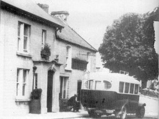
Forkhill today has become somewhat of a dormitory village with extensive new housing largely out of character with the village we so love.  It retains its unique appeal however, and is an ideal site from which to explore the charms of South Armagh.
 
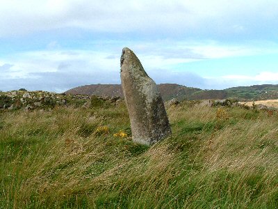
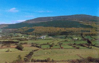
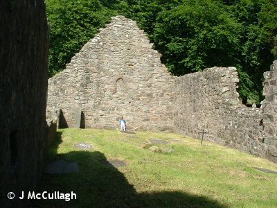
In the nineteenth century it was quite an industrial village with a corn mill, a scutch mill, a hotel, a post-office and several grocery and drapery shops.  There was also a Petty Sessions Court once a month and frequent fairs.  The surrounding countryside was sown in oats and flax and potatoes.  In 1881 its population was 177.  The main attraction then for tourists was a trout lake on Alexander’s estate which also had picnic sites.  It sits at the western end of Slieve Gullion which dominates the skyline.  Just outside town in the townland of Shean were the remains of an ancient priory.  Urney Graveyard is a half a mile away.
 
Squire Richard Jackson (remembered in the beautiful song The Boys of Mullaghbawn, elsewhere quoted here) was the most renowned local landlord, highly thought of in life, though one clause in his will which clearly discriminated against the majority population caused untold hardship after his death. 
 
Forkhill school under his bequest had a schoolmaster called Knowledge (a nickname, it is believed, deriving from his profession) who was willing to teach the local children their prayers in their native tongue.  The Rector Rev Edward Hudson (1779-1795) removed him and replaced him with a teacher named Barclay who would ‘educate the children in the Established Church’ as the bequest had stipulated – teaching the ‘Established Church Prayers’ in English.  Barclay had a brother-in-law, Dawson, who was Hudson’s bailiff and rent collector, and a spy and informer.  On his word two local men were convicted of some crime, one named Bennett being transported and the other, Donnelly being subsequently hanged.  Dawson was also the chief suspect when the parish priest’s home was broken into and his holy vestments shredded.  Local anger boiled over.
 
A group of local Raparees set out in search of Dawson, but failing to find him attacked Barclay instead.  Three members of one family were caught, tried and sentenced for this crime, one being executed.  Local tradition has it that they were all innocent.  English security presence in the area increased.  On December 19th 1789 the Rev Hudson was himself shot at and the horse under him was killed.  The whole area including nearby Mullaghbawn was active in the United Irishmen insurrection at the close of that century.


There are some among the older generation of Forkhill who still remember the mills operating.  One was owned by a family called Brooks and one by a family named O’Neills. 
 
Local farmers had their corn threshed by steam threshers in the field.  It was then taken in sacks to the mill in Forkhill.  It was crushed fine and made into pollard (crushed oats with nothing removed).  This was a winter foodstuff for cattle.  Farmers took their oats themselves to the mill by horse and cart, and were willing also to take their neighbours bags of oats with them.
 
The flax mill employed a lot of local people as scutchers and beetlers of the flax.  Flax was grown locally and at Dungooley, Co Louth, just a mile away.  At flowering flax fields with cornflower blue flowers on long, thin, delicate stalks was a sight to see!  At harvest it had to be pulled from the ground, a back-breaking task.  It was left to rot (retting) weighed down in flax-holes in a stagnant pool and creating the most awful stench.  When it was judged that the stalks had separated it was brought to the mill to be scutched and beetled.  Then it had to be bleached on bleach-greens.  Men from the mill used to go door-to-door to collect urine from chamber pot for the purpose!  The ammonia did the job!  The final product, linen, became the staple product of Ulster.  Expensive to buy, it was made into bedwear, tablecloths, underwear and the like.  These were sold abroad where people could afford such luxuries.   
 
Today mills are found only in large towns or cities.  Linen making is a smaller, specialist enterprise and almost all local, rural mills have closed.  It was the increasing popularity of the more versatile and softer cotton cloth that caused the linen trade to collapse.
 
Forkhill retains its rural charm and much of its traditions.  Don’t miss out on it in your travels through South Armagh!

Mountains Identified

warrenpointtown.jpg

The highest mountain on the Ring of Gullion is the elongate Camlough which on its eastern end sweeps towards Derrymore and Althaveigh until it merges with the Bernish at Cloughogue.  On the far side of the main Dublin Road Fathom Mountain sweeps east and south.

Those mountains that define the horizon from the beach at Warrenpoint are different both in aspect and indeed in constituent minerals, origin and date of intrusion and emergence to the surface.  Anglesey Mountain is behind Omeath and has a very scenic drive up past the Long Woman’s Grave.  That’s a story I have yet to tell you!  It merges at its southern end with Carlingford’s Slieve Foye.  This is all our natural hinterland, but again a story for another day.

The Ring doubles back through Clontygora to cross the ‘border’ at Derryhale.  The fortified hilltops in that vicinity are evidence enough of the limits of political jurisdiction.

The Ring is completed with Aughnaduff Mountains, Slievenacappal, Croslieve, Slieve Brack [at Forkhill], Mullaghbane Mountain, Lislea or Courtenay Mountain, Sugarloaf Hill, Sturgan Mountain and Carrigan’s Hill.  The hilly road that climbs from the northern end of Camlough Lake is called Sturgan Brae – always I thought, a beautiful name incorporating the Gaelic into one’s everyday language.  If one had still to climb it by Shank’s mare, or horse and cart, one would have time enough and to spare, to drink in the wonders of nature that are all around. 

Slieve Gullion, the remains of a long-extinct and collapsed volcano is in the centre and is the highest point.  Its ‘tail’ at Drumintee points towards Forkhill.

Within the Ring [see map elsewhere here] there is a sizable extent of intrusive Newry Granite and the ring itself is mainly of grantitic composition.  There is a little disused quarry on the road from Camlough to Meigh, beside a scenic amenity site that overlooks the beautiful lake from a height of 100 metres, where one can see clearly – because of different coloration – where distinctly different intrusions [both of composition and time] have emerged close to the surface.  [I ruined a good pair of trousers on trailing briars, investigating this information for you – so consider yourself warned!].

Does every hill have a name?  For dear’s sake, it’s not so long ago that every field had a name, as well as every farm animal. 

Ought we all not to slow down a little?