Earth is about four thousand seven hundred million years old. Rocks, the subject of geology, are regularly re-cycled and the oldest known surviving rocks (in Greenland) are some three billion years old.
Mountains are continually raised and lowered to the sea. Considered against such enormous time scales, our species homo sapiens has been here for just an instant past, and yet has made noticeable changes to the Earth’s surface, and more recently to its atmosphere. The latter is increasingly manifest in anthropomorphic climate change. Happily, larger and more long-lasting geological effects – the raising and lowering of mountains, the opening and closing of oceans – are beyond our control. We can however study the morphology of such cataclysmic events from the rock evidence all around us.
A number of Earth’s locations – the Grand Canyon and the Great Rift Valley – are ideal sites for such study. It is less well known that we occupy a unique geological niche too.
Did you know, for example, that this place once was on the edge of a huge continental lithospheric plate called Laurentia: that what we now call the Americas, along with the northern part of Scotland, shared this plate with us: that England and Wales, along with Leinster and Munster (imagine Ireland cut in two along a line from Carlingford to Galway Bay) were part of a different continental plate that was thousands of miles and 30 degrees of latitude separate from Laurentia, across the huge Iapetus Ocean?
At that time, we were 10 degrees south of the Equator (a latitude similar to Rio de Janeiro today) and ‘ Dundalk ‘ was at 40 degrees South, similar to New Zealand today.
In the millions of years that followed, these plates came together. In the collision (ours was the lighter, more buoyant continental compared with the denser oceanic plate) the sediments at the Laurentian margin were successively compressed and raised in an accretionary prism adjacent to the subduction zone.
Clays were metamorphosed to shales and horizontal strata became vertical, forming what today is the Longford-Down Inlier. The first rocks raised (and the youngest) are at the Longford end, indicating direction of motion as well as relative age. We might say then that those shales at the east Down end, belonging to some ancient sea, are the oldest, except that the sequence continues beyond the Irish Sea to the Southern Uplands of Scotland.
Mountains-to-be formed within this margin, here the Mournes, Slieve Croob, Slieve Foye and Slieve Gullion, but deep in the bowels and not at the surface of the earth. The enormous continent that formed at this era was Pangea, meaning all land, for indeed it was almost all the then-existing Earth land surface.
Subduction zones, where enormous slabs of denser oceanic plate delve several miles into the mantle, are associated with volcanic activity as these hydrated rocks melt under heat. A different drama unfolds whether or not the resultant magma is able to escape to the surface. If it does, it may form volcanoes, belching out lava, or escaping through enormous fissures: then it can form flood basalts as in the Antrim Plateau (the Deccan flood basalts of the Indian sub-continent are a more dramatic instance). It may rise in a peculiarly unique fashion to form features like the Giant’s Causeway. If it is forced to cool miles beneath the earth over long ages, then an enormous granitic pluton, like an upside down mountain, forms between the mantle and the earth’s crust. It may take further cataclysmic events, like lithospheric plate collisions, or millions of years of erosion, or even a meteor impact, before their crests are exposed to the light of day.
We must appreciate that much of the original shale covering has not yet be eroded from the igneous rock base all around us. Such erosion is evident in quiet river estuaries where tidal forces are insufficient to wash them into the deep sea. This is evident in the mud flats of our own tidal estuary from Greenbank to Narrow Water.
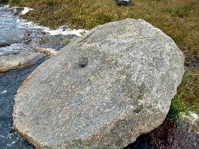
The Mournes are of four different forms of granite [E E Evans, Mourne Country 1966] and Newry granite to the north and west (Goraghwood Quarry, for example) is of a different form again. Slieve Foy or Carlingford Mountain is composed of another igneous rock called gabbro. The differences are a factor of the original minerals composition and of the depth at which they formed. Greater depth means higher pressure and temperature. Igneous and sedimentary rock can be changed (metamorphosed) under these conditions. Chalk, for example, can be transmuted to marble. Other metamorphic rocks include schist.
Cast your eye along the skyline at the summit of Slieve Foy and you will notice a more rugged profile than that of the Mournes on the other side of the Lough, a reflection of the gabbro’s hardness, and its peculiar fault lines that result in a dirrerent erosion pattern. The ancient Norse word for Witches, Karjling, gave its name to this fjord, for those three peaks on one of the higher peaks, could be used by sailors to safely navigate a passage through this treacherous seaway.
You may also notice a different form of vegetation on the mountain slopes. If you look closely you may see the edge of the ice-line, where glaciers of the most recent ice age, some 30,000-15,000 years ago did not completely cover the mountain tops as they retreated towards the sea. When you remember that our region has five thousand years of uninterrupted human habitation, you will appreciate how quickly after the ice retreat man occupied these lands.
~~~~~~~~~~~~~~~
The principal geological events so far outlined took place in the Devonian period (when Devon/Cornwall pluton formed) of the Palaeozoic Era. The latter word means of the ‘oldest life’ forms. Indeed the Caledonian (meaning late Silurian to early Devonian) was the period of earth’s first forests, 400 million years ago. The first amphibians crawled onto land. Later the first reptiles evolved.
The laying low of huge forests in the Carboniferous led to the extensive long-term sequestration of carbon (which man mines for energy) and high oxygen atmospheric levels. The latter brought a proliferation of animal life forms, up to the time (at the end of the Permian) of the greatest of all extinctions.